
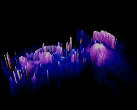
photographic terrains 1 & 2 – are abstractions of photographs in space. Playing against the intended function of geographic information system software, the photographs from crysalis and photism are mapped via their surface information into three dimensions. This process involves plotting the information of each pixel within a photographic image – assigning it a value based on its tonal intensity. The resulting collection of values are then transposed onto x,y,z axes – the phase space portrait of the photograph’s surface information. The resulting artifacts are digital topologies of photographic surfaces. The photographs are not just translated into digital form, completely new information is generated and employed; transforming two dimensions into three. It offers a new kind of photographic objectness.
Exhibitions:
2008 Fringe Exhibition 139 Gallery, Adelaide, Australia
2007 ABN AMRO Exhibiton, Sydney, Australia
2006 photofugue: solo exhibition, SASA Gallery, Adelaide, Australia